
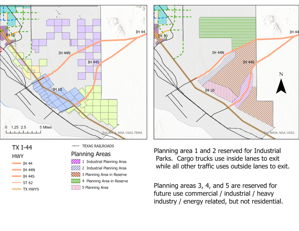
On the left side map, it shows three major public land owners while the right side map shows possible land use as an example. Industrial planning areas 1 and 2 parallel along the split I-44 north and south. These would be 4 to 6 miles corridors approximately 1/2 mile wide where several industrial parks would be located.